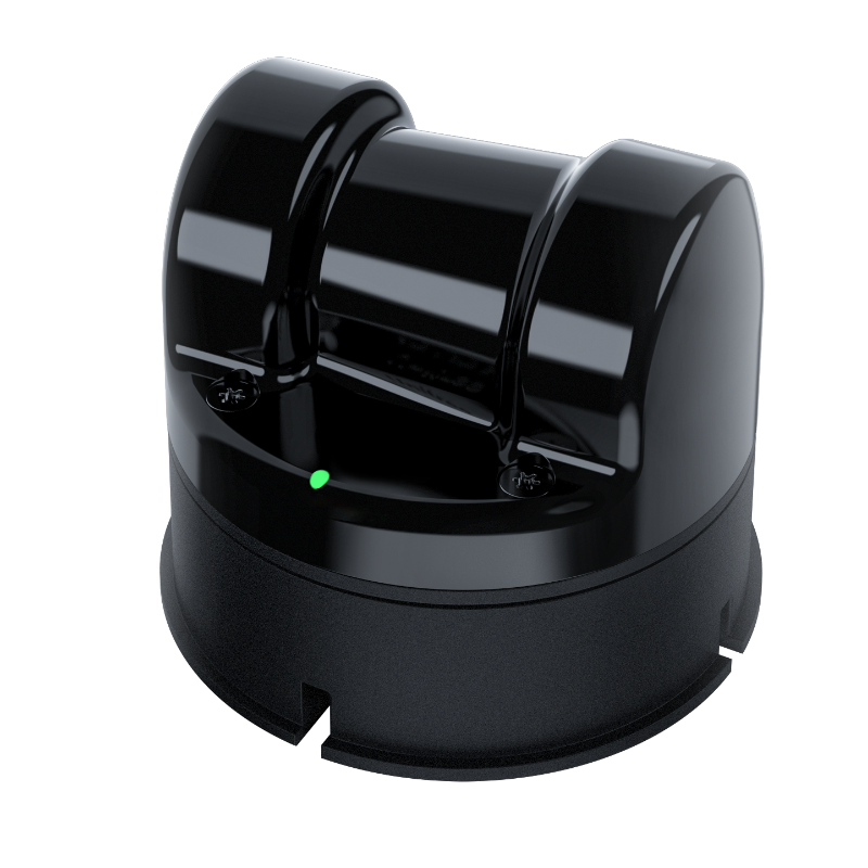
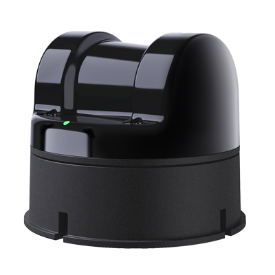
Unitree 4D LiDAR
Unitree 4D LiDAR from Unitree Robotics


Beschreibung
Unitree 4D LiDAR
All NewL2
Provide a complete open-source SLAM solution.
Utilize only L2 and its built-in IMU, without employing other positioning sensors, to map using the POINT-LIO algorithm.
|
360°×96°[1] Ultra-wide-angle scanning |
0.05m[2] Near blind spot |
30m[3] @90% reflectivity |
64000 points/s Effective frequency |
|
2cm[4] Measurement accuracy |
230g Weight |
ENET UDP/TTL UART Communication interface |
75×75×65mm Compact size |
|
|
|
Indoor whole-house dynamic scanning.
L2 can quickly and accurately obtain the 3D structural information of the entire house, which facilitates the positioning and autonomous navigation of mobile robots. It can also help robots expand more diverse functions such as whole-house cleaning and organization.
Outdoor real-scene dynamic scanning.
L2 can effectively resist the interference of indoor ambient light and outdoor strong light. Under strong light conditions of 100Klux outdoors, it can achieve stable ranging and high-precision mapping.
Non-repetitive scanning
L2 achieves high-precision and high-density point cloud data through omnidirectional ultra-wide-angle non-repetitive scanning, realizing photograph-level scanning effects.
Recommended deployment scheme examples
Logistics and warehousing / Intelligent distribution / Sweeping robot / Intelligent Industry and Agriculture / Smart Factory
Product Model
|
Model |
L2 |
L1 PM (Precision Measurement) |
L1 RM (Remote Measurement) |
|
Scanning distance |
30m(@90% reflectivity) 15m(@10% reflectivity) [3] |
20m(@90% reflectivity) 10m(@10% reflectivity) |
30m(@90% reflectivity) 15m(@10% reflectivity) |
|
FOV |
360°×96° [1] |
360°×90° |
360°×90° |
|
Sampling frequency
|
128000points/s |
43200points/s |
43200points/s |
|
Effective frequency |
64000points/s |
21600points/s |
21600points/s |
|
Communication interface |
ENET UDP/TTL UART |
TTL UART |
TTL UART |
|
4D data |
3D position +1D grayscale(supports 2D mode) |
3D position +1D grayscale |
3D position +1D grayscale |
|
Circumferential scanning frequency |
5.55Hz(Customizable adjustment) |
11Hz |
11Hz |
|
Vertical scanning frequency |
216Hz |
180Hz |
180Hz |
|
Distance resolution |
4.5mm |
8mm |
8mm |
|
Measurement accuracy |
≤ 2.0cm [4] |
± 2.0cm |
± 2.0cm |
|
Nearbyblind area |
0.05m [2] |
||
|
IMU |
3-axis acceleration +3-axis gyroscope |
||
|
Human eye safety level |
Class 1(IEC60825-1:2014) Human eye safety |
||
|
Anti-glare capability |
>100KIux |
||
[1] L2 also supports negative angle mode, in which the field of view will be extended from 360°x90° to 360°x96°. The additional 6° of the field of view will have a slightly shorter maximum measurement distance.
[2] The values shown here are typical reflectance values, and the actual values depend on environmental conditions and the characteristics of the target object.
[3] To ensure effective detection of objects with different reflectance within the range, there may be a slight decrease in point cloud accuracy at certain positions. The farthest range is directly above the L2.
[4] To ensure effective detection of objects with different reflectance within the range, there may be a slight decrease in point cloud accuracy at certain positions.
[5] The stable power and peak power vary under different environmental conditions. When the ambient temperature is between -10°C and 30°C, L2 will automatically operate in a self-heating mode. Point cloud data will be generated only when the temperature meets the requirements, and at this time, the peak power can reach 13W. Please design the power supply reasonably to ensure the normal operation of the equipment.
[6] This product is a civilian robot. We kindly request that all users refrain from making any dangerous modifications or using the robot in a hazardous manner.
[7] Please visit Unitree Robotics Website for more related terms and policies, and comply with local laws and regulations.
* Note: The parameters mentioned above may vary in different business scenarios and with different LiDAR configurations. Please refer to the actual application for accuracy.


")
")
")